City Halls
Real Estate Tax Collection
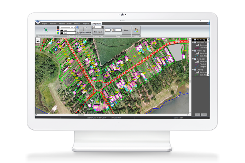
Through the application of geoprocessing technologies with high resolution images and updating or creation of a cartographic base (georeferenced digital map), it is possible to easily identify territorial areas and building constructions and so detect and correct distortions, enabling the tax regularization and updating of city hall records, generating a considerable increase in tax collections of IPTU, TBI, ISSQN and fees.

City Halls
The presented solution is customized according to the public administration needs and can be expanded and integrated for the spatial management of the following areas:
SIGATI
Our highly qualified teams of developers constantly work with updates and improvements, in addition to developing solutions according to the specific needs of each customer in an agile, effective and qualified manner.
SIGATI REAL ESTATE
The system also allows the mapping and registration of trees, springs, erosions, and rain drainage.
It also allows the mapping and registration of collection points, sanitation network, recycling points, etc.

EXPERTISE IN THE ENVIRONMENTAL SECTOR
We operate in the development of projects and solutions for the public and private sectors according to the needs of each customer. There are more than 50 city halls served through environmental consulting in the urban and rural planning area.

PREPARATION AND REVIEW OF CITY PLANS
- Integrated Solid Waste Management Plan
- Basic Sanitation Plan
- Urban Macrodrainage Plan
- Rural Erosion Control Plan
- Wells Granting and Regularization
- Streams Recovery
- Master Plan
- Urban Mobility Plan
- Plan to Fight Against Water Losses in the Public Supply System
ENVIRONMENTAL PROJECTS AND STUDIES
- Preparation of technical and operational evaluation for the sewage treatment system including adequacy and/or expansion
- Adequacy project and/or preliminary studies to expand the sewage treatment system
- Project for replacing public water supply network piping
- Selective collection program
- Feasibility study of waste landfill implantation
- Waste landfill closure project
- Waste landfill project and licensing
- Solid waste landfill expansion project
- Reforestation and/or Environmental Compensation Project
BLUE GREEN CITY PROGRAM
- Urban Afforestation Plan
- Forest Inventory/Trees Register in the urban area
- Other consultancies
FUNDRAISING
- FEHIDRO Projects
- Electronic proposal registration
- Summary sheet
- Budget worksheet
- Physical-financial schedule
- Reference statement
- Basic project
- Descriptive memorandum
ENVIRONMENTAL ADVICE FOR LICENSING
- Vegetation Suppression Authorization
- PPA (Permanent Protection Areas) Intervention
- Granting
- Area licensing for transshipment and/or final disposal of CCR (Civil Construction Residues)


